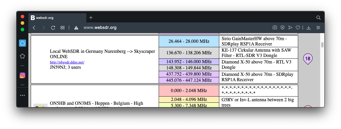
Find a WebSDR with service on 137 MHz, such as Nuremberg, as shown below.
Repeat the process a few more times to find several different locations to test.
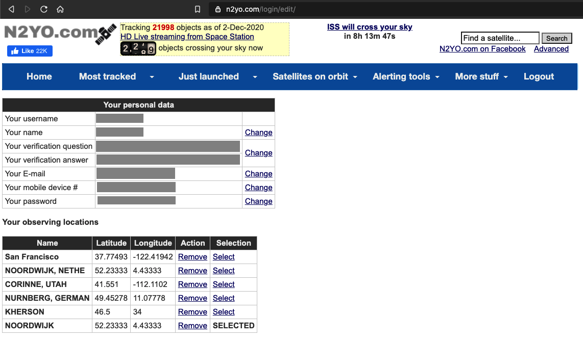
Create an account. Specify your home location accurately so it will know what time zone you are in.
At the top of the page, in the blue menu bar, click "More stuff", "EDIT/CHANGE YOUR LOCATION".
Add your other observing locations, as shown below.
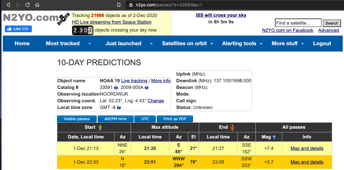
Select one of the WebSDR locations.
At the top of the page, in the blue menu bar, click "Most tracked", and choose one of these three satellites: "NOAA 15", "NOAA 18", or "NOAA 19".
At the top left, click "10-day predictions".
Find a tine when the satellite passes high in the sky, at least 70 degrees up.
In the image below, there's a good pass on 1-Dec from 22:53 - 23:09 (San Francisco time), as shown below.
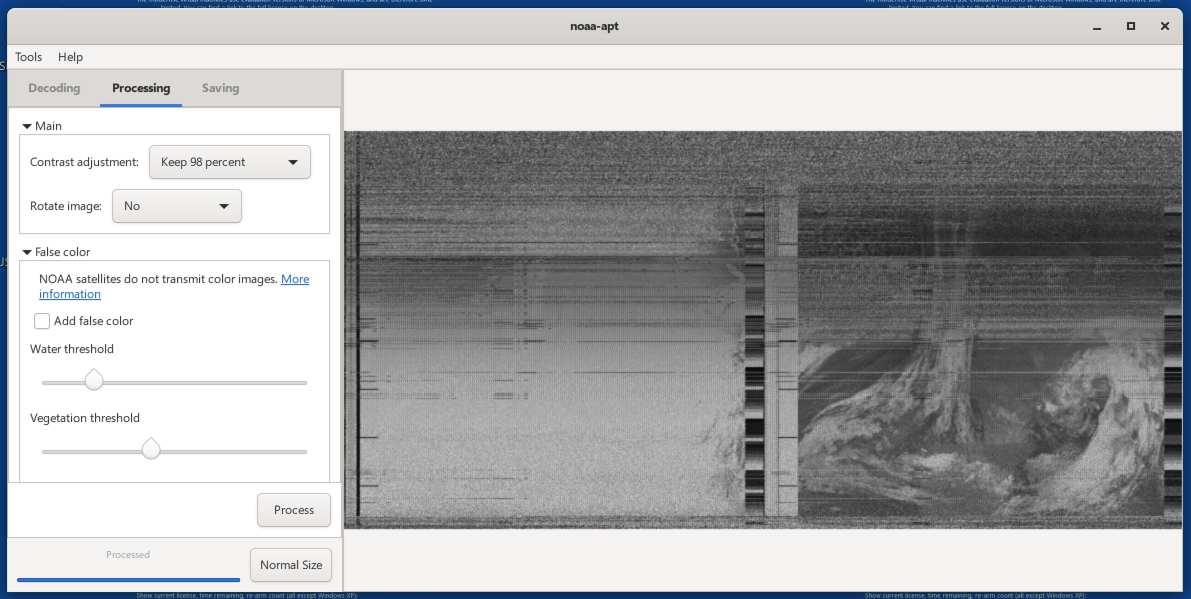
When the satellite passes overhead, you should hear the beeping and see the signal in the waterfall display, as shown below.
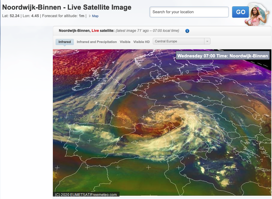
This is a photo of the clouds over the Netherlands, as shown in this live satellite image I found on Google:
SP 110: Images (20 pts)
Submit two images for comparison:
- One from your WAV file
- One from a live satellite image taken at the same time and place